Gardner Cave is about as far north as you can get in Washington before going into Canada. Low and behold there is even a hiking trail leading to the 49th parallel, and the trail takes roughly 30-40 minutes to hike both ways. It’s a fun little side expedition while waiting for one of the guided cave tours to start. These are the two highlight activities available in Crawford State Park, which in itself seems like a pretty average place at first glance. Designated as a day use park Crawford does not offer camping, however campsites are available about a mile a way at Boundary Dam. The only fees associated are the fact that visitors will need a Discover Pass as is standard for Washington State Parks. The cave is the most common reason visitors come to see the area though, and that is for good reason.
The cave itself was first discovered by Ed Gardner while he was riding his horse. As the tale is told Gardner’s horse stumbled into a soft spot that he would eventually discover to be the cave. Some sources say it was found as early as 1899, but other accounts credit Gardner’s find around 1903. The very early history of the cave is not very well known, although most agree it was used to hide Gardner’s bootlegging business. He would later lose his land to William Crawford during a game of poker as legend has it. Crawford would in turn donate the land to become part of the Washington State Parks system. Holly Weiler explains that in the 1930’s the Civilian Conservation Corps installed some picnic areas. Her publication on Out There Outdoors also shares that the cave was not updated for tourism until the 1950’s while the most recent installations happened in 1977.
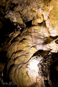
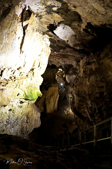
The geologic history spans a much greater timeline however, and some sources such as this report on the Washington Trails Association website date the cave at 500 million years old. Dated that far back, the site was actually an ocean floor at the time. The process of decomposition in the shells of sea creatures eventually produced a sort of slime that would harden into limestone through time. As tectonic plates shifted and moved, the were times when the limestone would also shift creating gaps and cracks. This would allow the moisture to run through the surface and down to create geologic formations. Being the 3rd longest limestone cave in Washington, Gardner Cave has a plethora of formations. These geologic structures as explained by Washington State Parks include stalactites, stalagmites, with some rimstone pools, and flowstone. Gardner Cave is also home to one of the most impressive columns in the region, and researchers estimate it to weigh nearly 8 tons. A column is formed when a stalactite meets a stalagmite, and spans from the cave floor to the ceiling. The tour guides explain these processes and much more during the actual tour, and for me it was a very educational and valuable experience.
The place isn’t too tough to find, and driving directions from Spokane, Washington are pretty straightforward.
Follow U.S. Highway 2 North, then turn left on State Route 211 toward Usk. Reaching highway 20 head north along the Pend O’Reille River. Upon reaching Tiger, take SR 31 toward Metaline. Keep an eye out for Boundary Road in Metaline and take a left turning uphill. Simply follow the signs from there. Google maps will also lead right to it for those with access to GPS via cell phone.
Thanks for reading!


