Uncategorized

Burke, Idaho

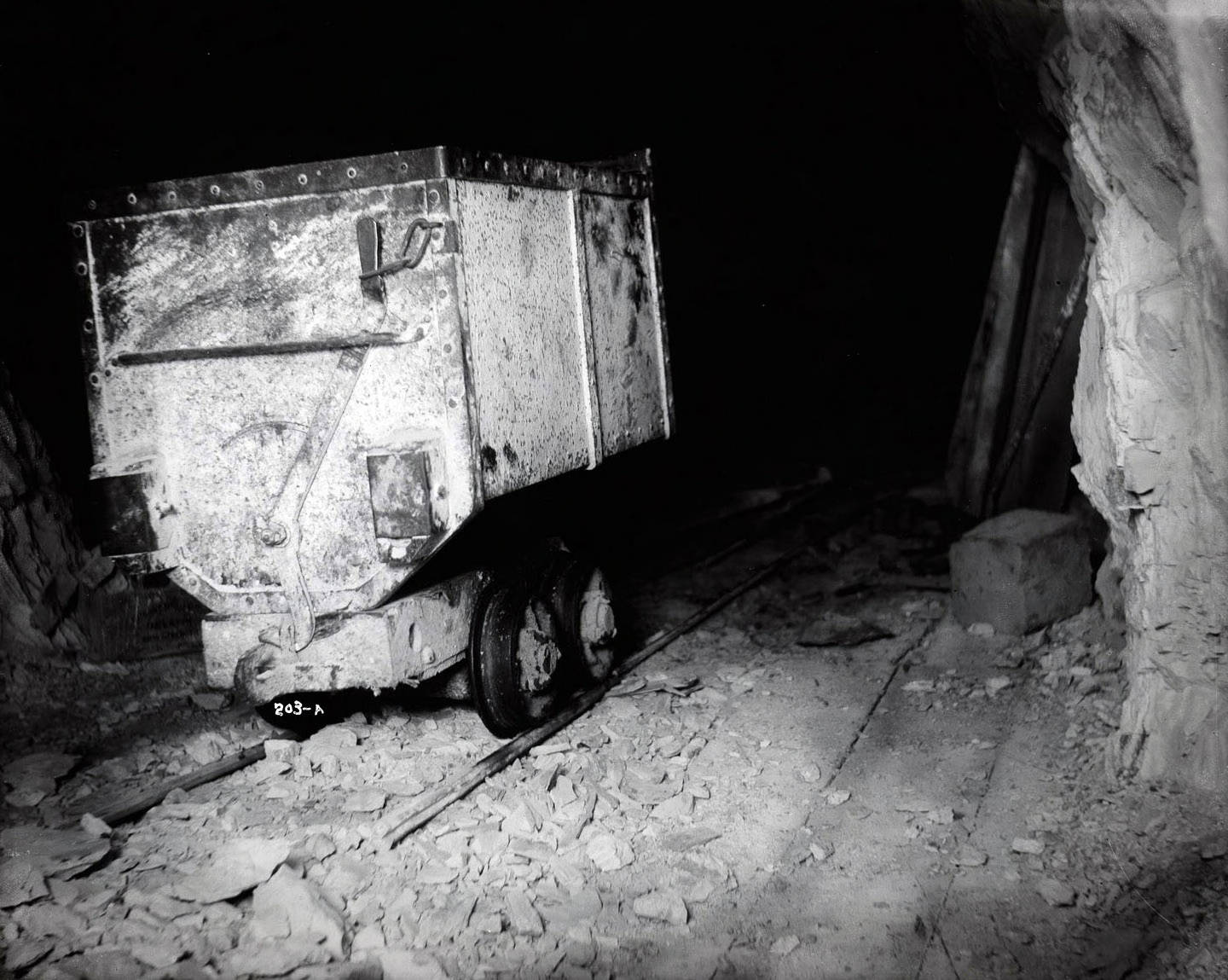
Burke is a small place tucked in a narrow canyon just a few miles from Wallace, Idaho. One of the many places of interest in north Idaho, this little ghost town faced hardship from the early days. In 1884 people in the area discovered deposits of silver, lead, and some zinc which stirred interest with a few notable people. According to https://www.onlyinyourstate.com/idaho/burke-ghost-town-id/ the Tiger mine was the first established, and it put out over 3,000 tons of ore during it’s first year.

This naturally led to a bit of a boom in the area, and in 1887 Burke was officially established. As explained by https://sfcompanion.blogspot.com/2020/06/burke-idaho-ready-for-almost-century-of.html?fbclid=IwAR2JEKUiQlvcFc9o-CPoS9iDHVOyaIginBxCSoHAVI8HMHMzDtUvlHXcz00, the town got it’s namesake from John M. Burke, who was a Virginian man that had been a banker in Utah. In fact the people that had discovered the mines didn’t have the resources to further develop the area, and thus bonded their claims to Burke. The biggest issue they faced early on was how to fit a thriving mining community in such a narrow canyon. The canyon measuring 300 feet wide proved difficult to build in, but they improvised and brought some unique ideas to life.

Tiger Hotel 1949-Reference link found below

Most notable of these constructs was the Tiger Hotel, which was the only hotel to be built with a road and train tracks going through part of the lobby. Builders also had to keep the substructure of the motel raised to allow Canyon Creek to flow underneath the building. This hotel had 150 rooms, and at it’s peak was said to feed around 1,200 people a day. It was even said the trains could be found parked in the lobby, because the engineers loved the food that came out of the beanery at the hotel. Most accounts tell a tale well respective of the Tiger Hotel, although it was sold and thus dismantled in 1954.

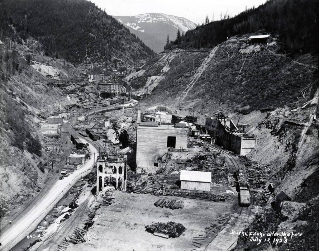
The town survived several natural disasters including avalanches, floods, and a devastating fire in 1923, the people continued to rebuild. A United Press Dispatcher recounted the events as detailed on https://westernmininghistory.com/towns/idaho/burke/, as quoted,

WALLACE, Ida., July 14. The town of Burke, seven miles east of here, lies in ruins as the result of a fire caused by a spark from a locomotive. Over fifty business houses of Burke’s main street were destroyed and practically all of the residences are gone. Four hundred and forty miners were forced to flee to the depths of the Hecla lead and silver mine. A high wind rendered dynamite ineffectual. All of the mine company’s buildings on the surface were destroyed. The damage is estimated at a million. Six hundred people are homeless. Army tents have been received from Fort George Wright at Spokane for the homeless.

Burke after the fire of 1923-Reference link found below

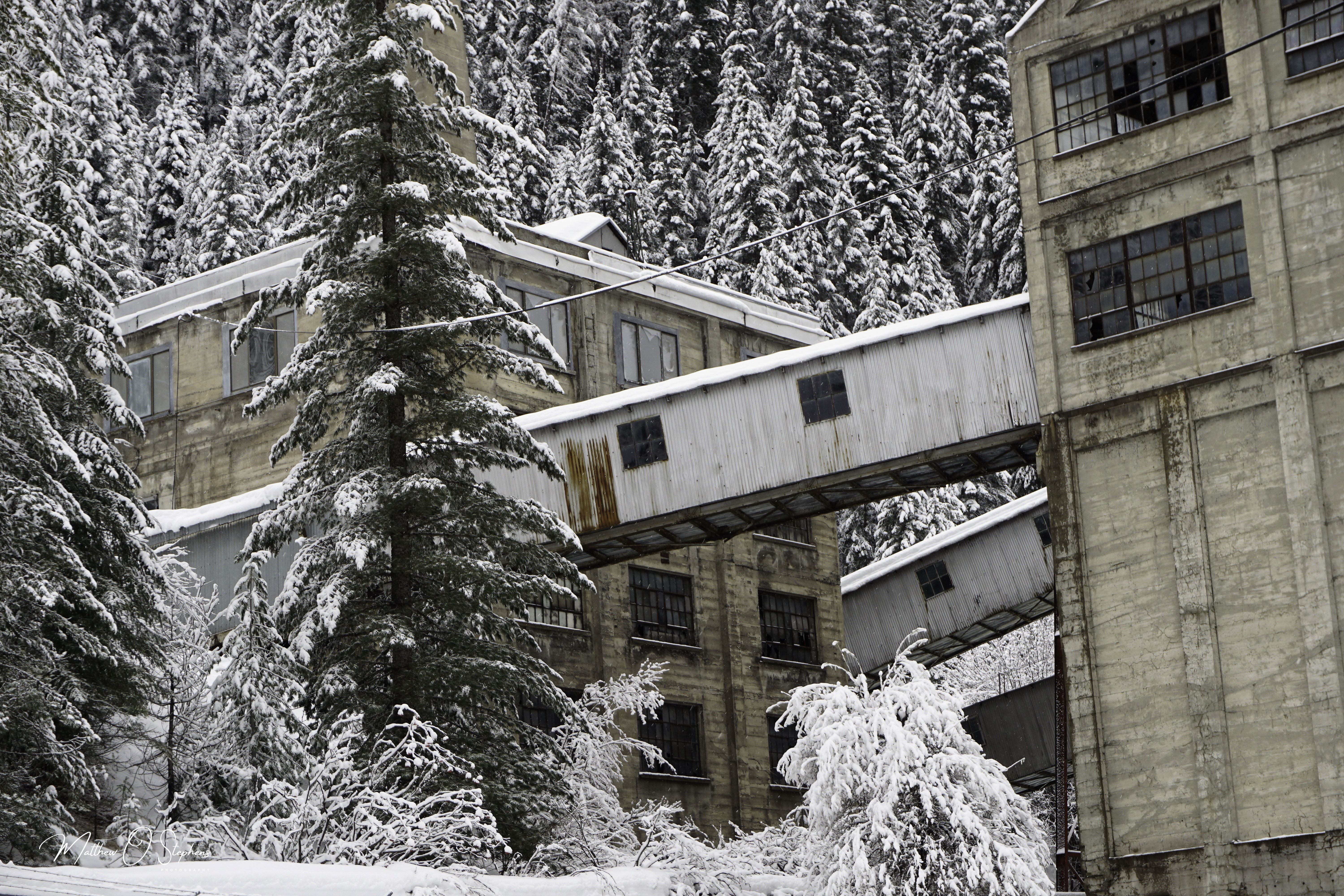
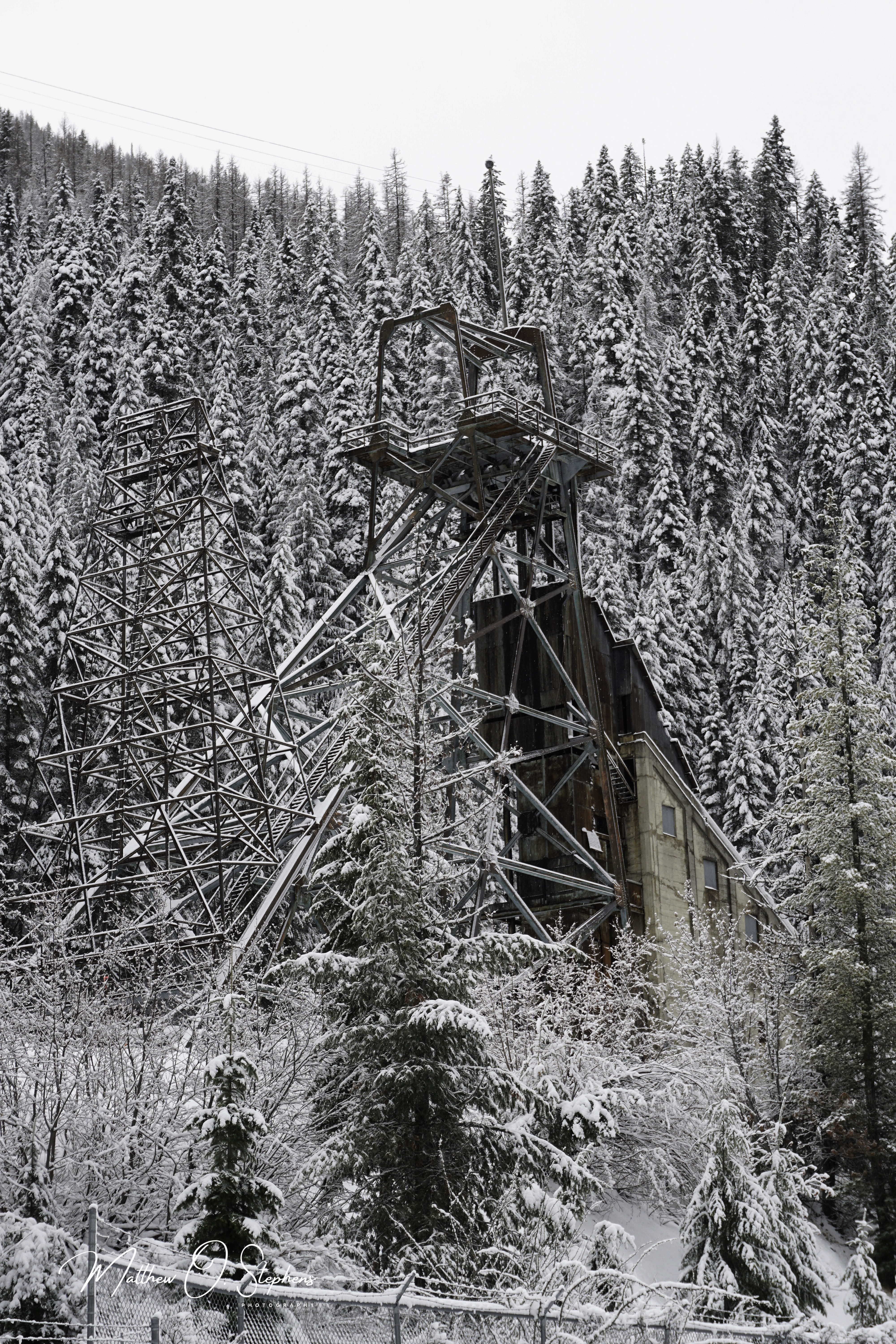
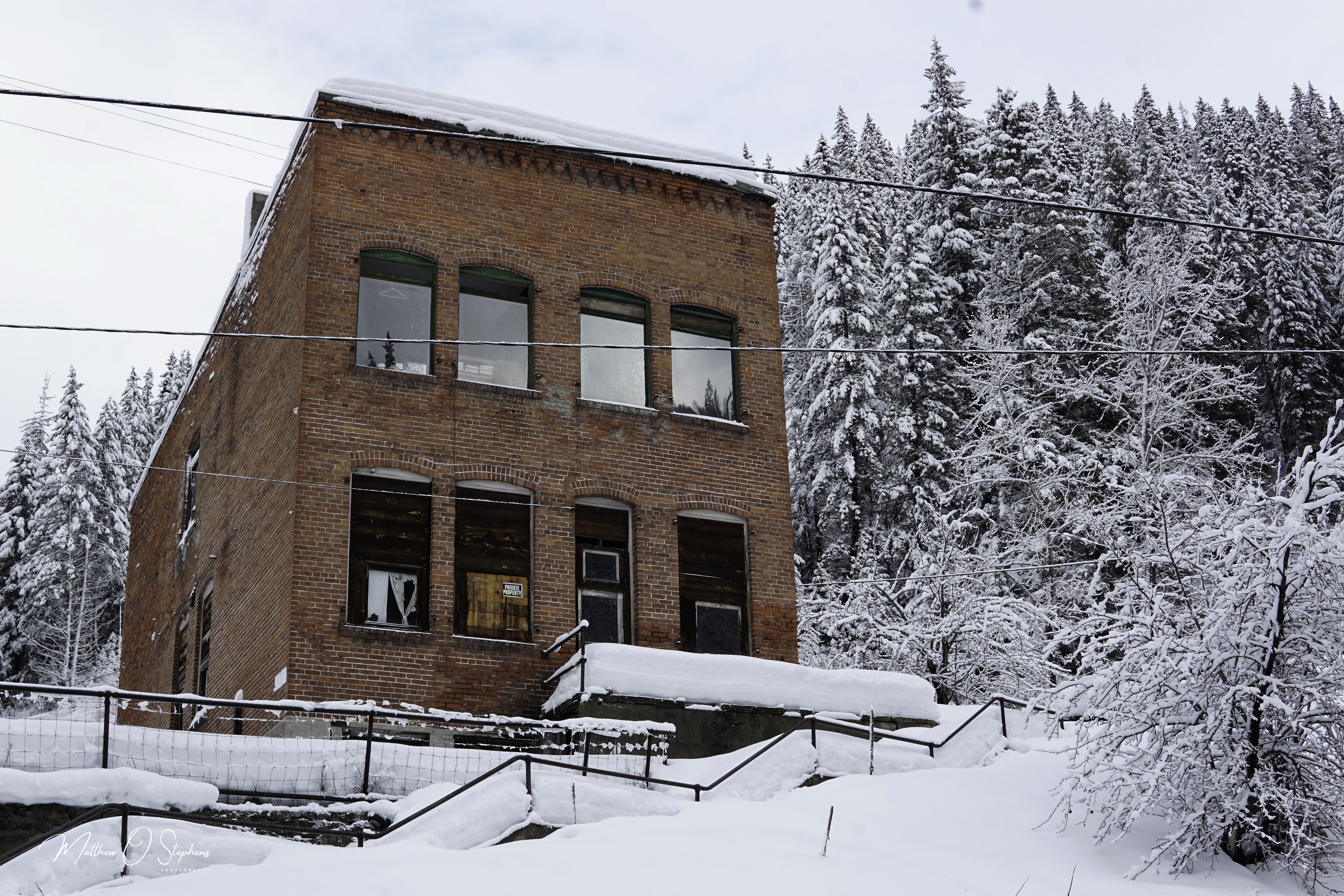
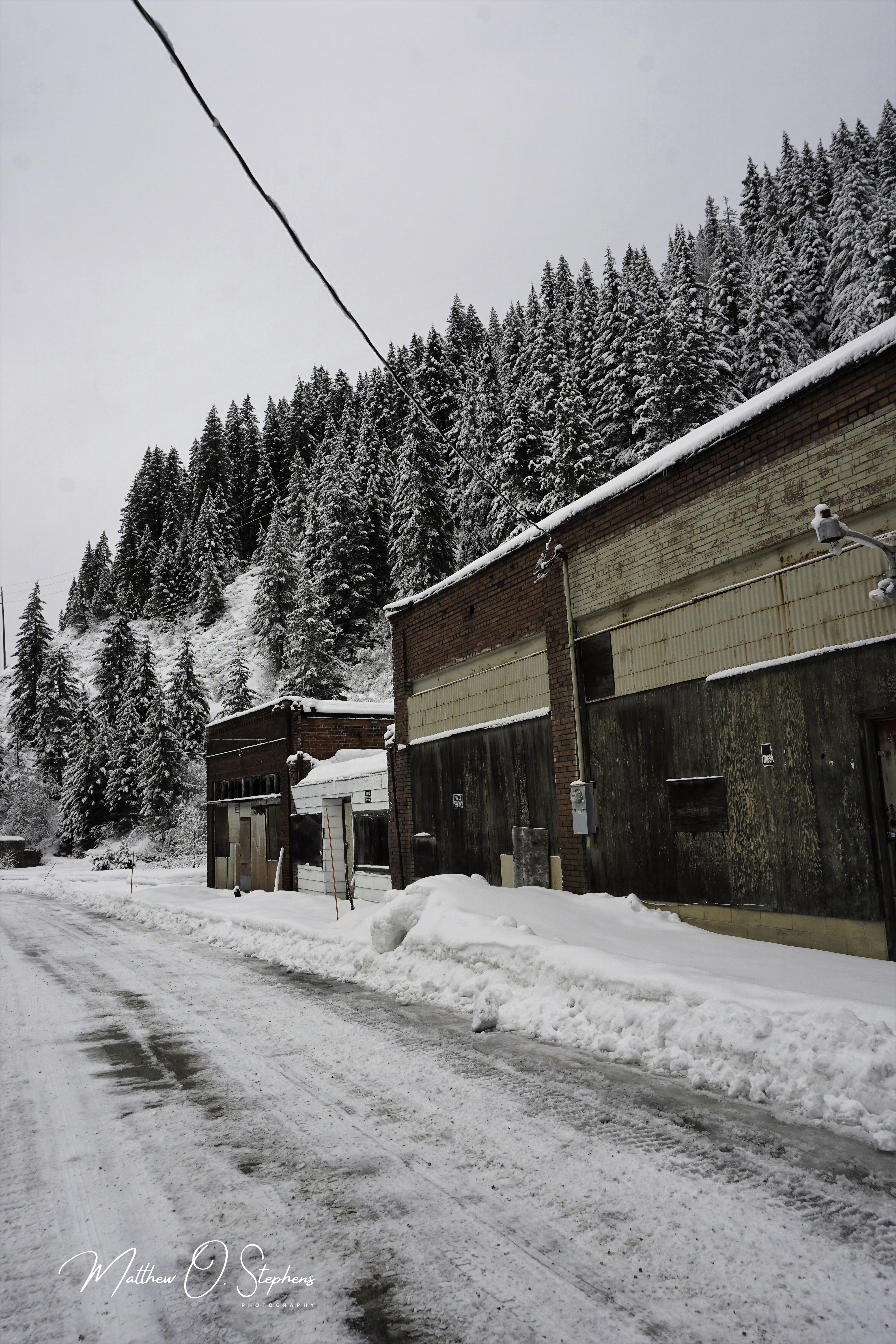
The mines continued to show their worth in production, but slowly they were closed down. This forced many of the workers to move and go elsewhere for work, leading to a continued decline in the population of this once thriving town. Now Burke is another ghost town, and the main buildings that remain are the colossal mining facilities, a few old storefronts, and an aging office building in which decaying books can still be seen through the windows. There are still some folks that live out there also, but only a handful.

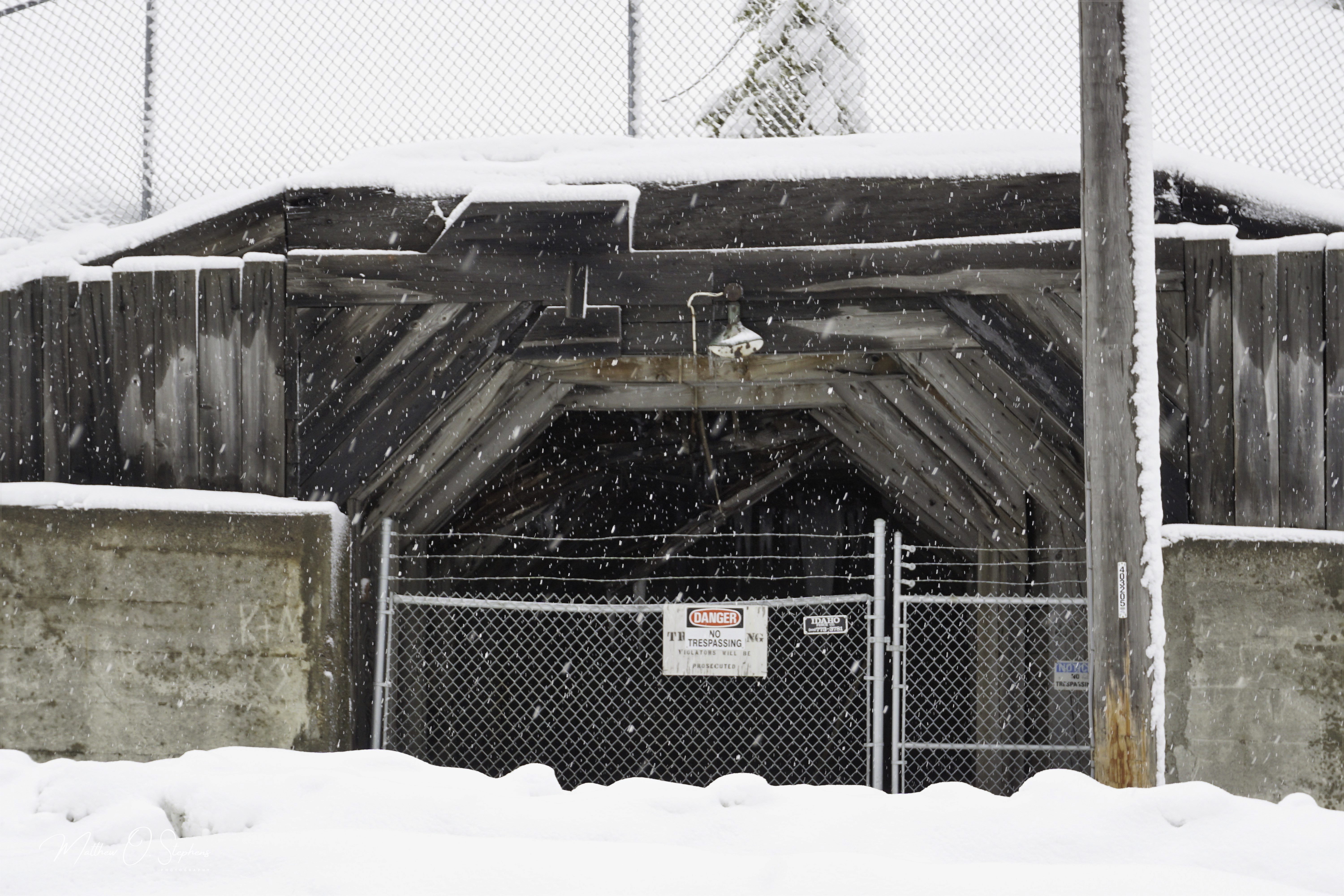
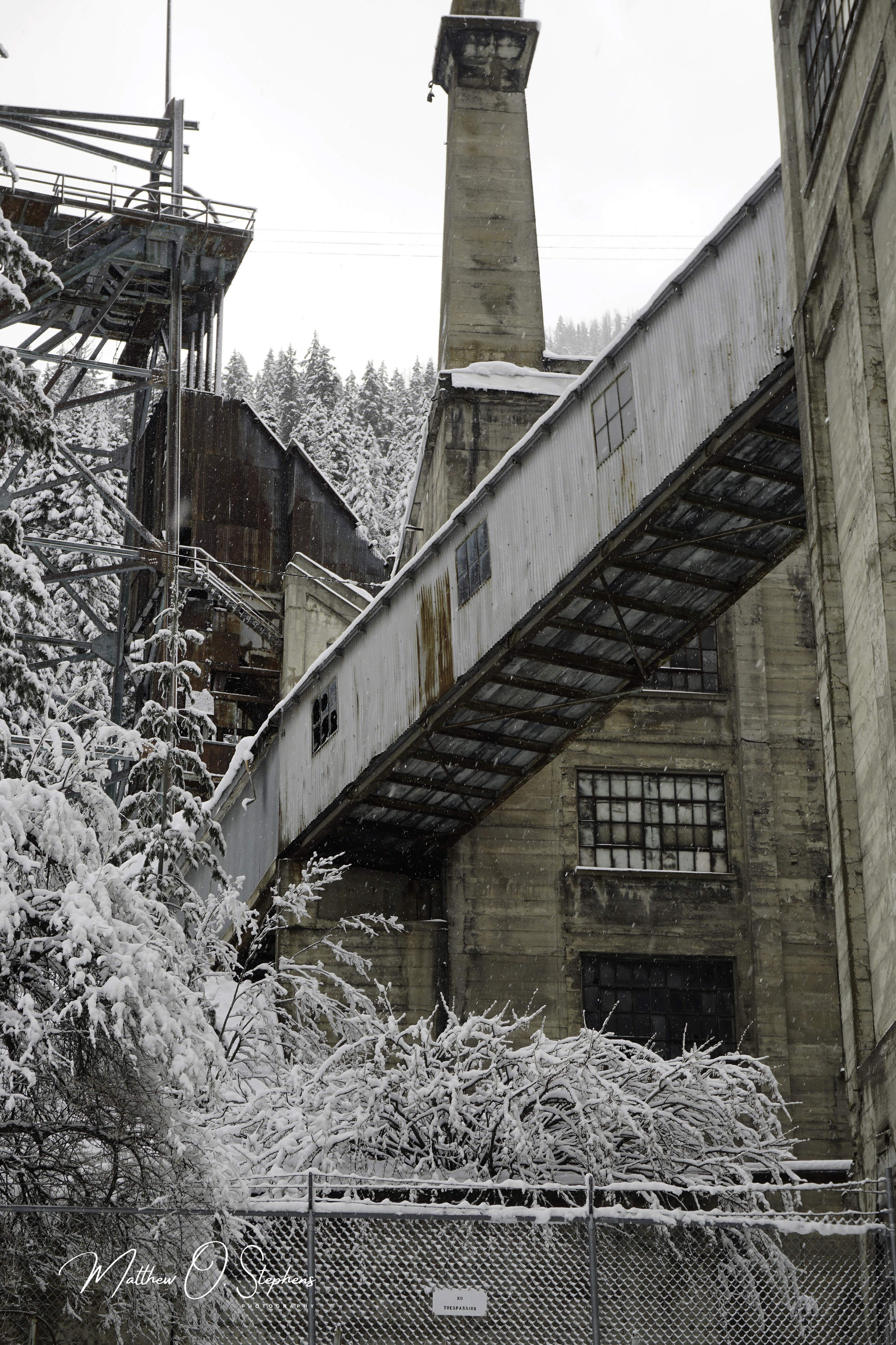
General Disclaimer: If you ever visit Burke please remember that people do live out there, and still own many of the buildings that stand. The buildings are marked “No Trespassing” for a reason, and that should be respected. Please be courteous, but also enjoy the incredible nostalgic feeling.

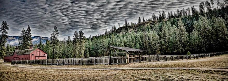
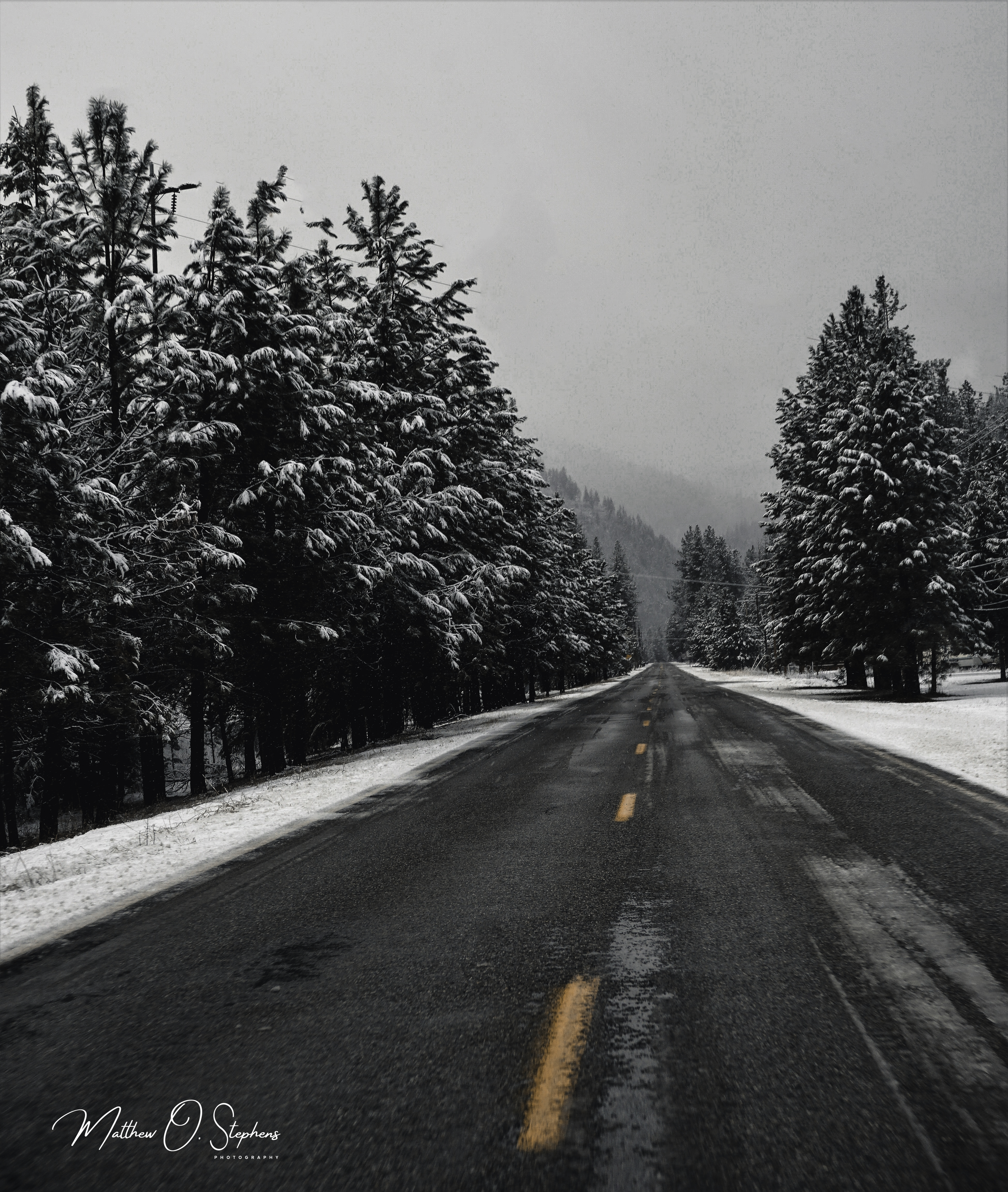
All of the modern photos were taken by Matthew O. Stephens Photography

Historic Photo References:

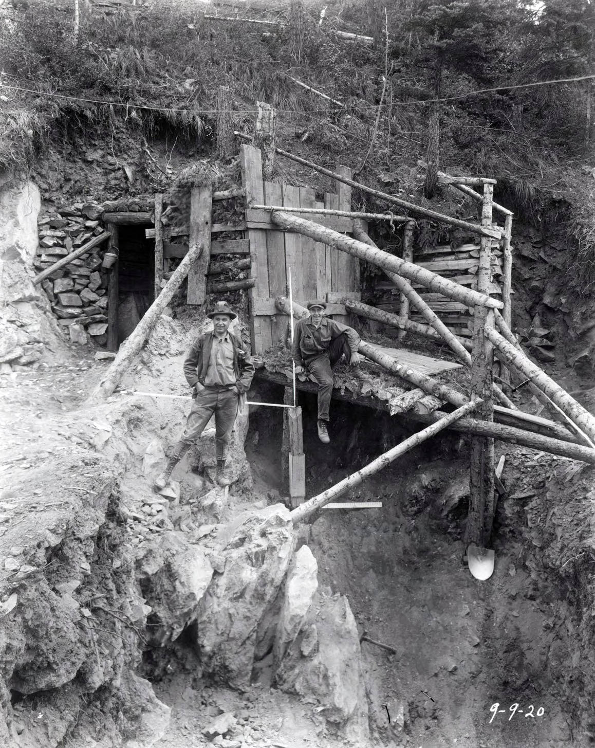
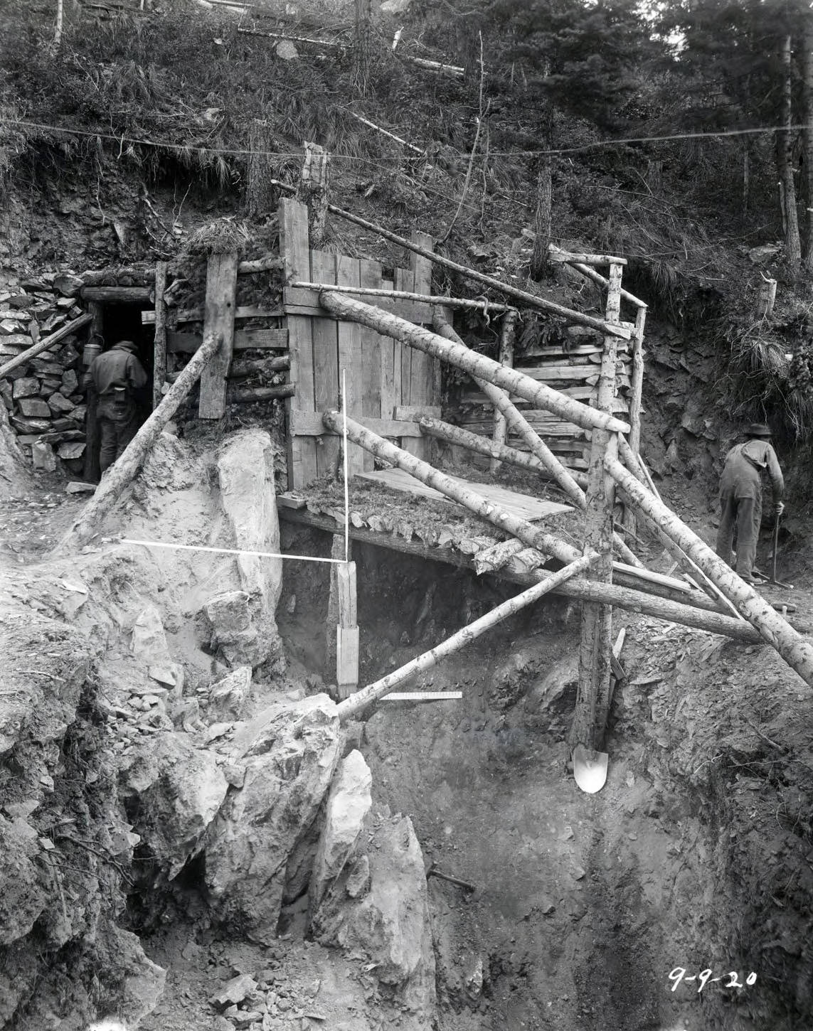
“Hecla Mine, Burke (Idaho) 1920 [09]”, Barnard-Stockbridge Photograph Collection, Digital Initiatives, University of Idaho Library https://www.lib.uidaho.edu/digital/barstock/items/barstock643.html

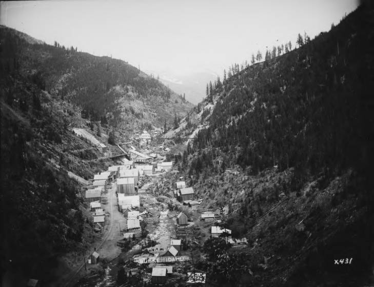
“Burke (Idaho), 1907 [02]”, Barnard-Stockbridge Photograph Collection, Digital Initiatives, University of Idaho Library https://www.lib.uidaho.edu/digital/barstock/items/barstock425.html

“Burke Fire [06]”, Barnard-Stockbridge Photograph Collection, Digital Initiatives, University of Idaho Library https://www.lib.uidaho.edu/digital/barstock/items/barstock1563.html

“Tiger Hotel [01]”, Barnard-Stockbridge Photograph Collection, Digital Initiatives, University of Idaho Library https://www.lib.uidaho.edu/digital/barstock/items/barstock1919.html

“Marsh Mining Co., Burke (Idaho) [02]”, Barnard-Stockbridge Photograph Collection, Digital Initiatives, University of Idaho Library https://www.lib.uidaho.edu/digital/barstock/items/barstock169.html

“Hecla Mine, Burke (Idaho) 1920 [11]”, Barnard-Stockbridge Photograph Collection, Digital Initiatives, University of Idaho Library https://www.lib.uidaho.edu/digital/barstock/items/barstock645.html

“Hercules Mining Company [05]”, Barnard-Stockbridge Photograph Collection, Digital Initiatives, University of Idaho Library https://www.lib.uidaho.edu/digital/barstock/items/barstock1279.html

PG 8, Barnard-Stockbridge Collection, University of Idaho Library Special Collections and Archives, http://www.lib.uidaho.edu/special-collections/ http://contentdm.lib.uidaho.edu/u?/barstock,849

All of the historic images referenced can be found at The University of Idaho, Barnard-Stockbridge Photograph Collection, and they state the rights as follows: Material has passed into Public Domain based on date of creation. Digital reproduction permissions assigned by University of Idaho Library. For more information, please contact University of Idaho Library Special Collections and Archives Department at libspec@uidaho.edu. https://creativecommons.org/publicdomain/mark/1.0/

Uncategorized

The Simple Paradise of Potholes State Park

Washington state has some really incredible state parks, and Potholes State Park is an amazing place to visit.  Sitting on close to 800 acres, it is aptly named for the geological features of the area.  Ice Age activity left a pattern of divots and channels through the area, and since the construction of the O’Sullivan Dam the landscape has a definitive series of “pothole” lakes.  These smaller pothole lakes are about 30-45 minutes away from the actual state park though, as it borders the deeper waters more suitable for boating and fishing as pointed out by the Washington State Parks  website.

Animals can be found aplenty during certain times of the year, and that includes eagles, owls, geese, and various mammals that wander through the park.  It is also nearby the Columbia National Wildlife Refuge, which can make for a nice drive while in the area.  Wildlife can be found wandering through the arid brushland, finding food or drinking from the freshwater pools.  People can camp at Potholes, and according to www.stateparks.com it features 61 tent spaces, and 60 utility spaces.  There are also a handful of cabins available to rent, and pets are allowed in certain cabins with an extra fee.

Referring back to Washington State Parks the fishing is pretty solid, and features large mouth bass, rainbow trout, crappie, and yellow perch.  Also plenty of open water for the people that simply want to get out in the boats and feel the air.  When looking to the air, visitors can expect to see a plethora of birds.  Small birds such as plovers and killdeer can be seen darting about the grass, while raptors such as owls and eagles will be seen during certain times of the year.  A wide open park area has picnic tables scattered about, and there are also 2 covered stations for people to eat if needed.  Several miles of hiking trails are great for park visitors after they have seen the immaculate waterfront.  Being a state park, visitors do need to either have a Discover Pass or purchase a day or year pass from the automated kiosk on site.

Thank for visiting, and be sure to subscribe to stay updated on some great places to visit in the Pacific Northwest!

Uncategorized

Lake Lenore Caves

Located in central Washington, the Lake Lenore Caves are a nice place to relax and catch some awesome views.  Hiking up the path from the parking lot, the trails are well defined and easy to follow.  Concrete stairs lead to the top of a section of basalt, and the trails splits at that point.  The easier terrain to navigate leads to the right, while also offering a more direct route to the caves.  The caves are very easy to find, as the trail leads right to them.  They are not extremely expansive by any means, but the caves are large enough for a group to sit and eat lunch or find a cool spot to rest for a bit.  Some more challenging landscapes are off to the left, and hikers should lead with caution when walking that path.  From what I understand, there are signs posted at points to show some dangerous areas that are not recommended for hiking.  Another thing hikers should keep in mind is to be on the lookout for rattlesnakes, as pointed out by the Washington Trails Association.


Geologically this area was formed during the last ice age, during a time of immense flooding.  Torrential waters raced through the area, and ripped away chunks of basalt creating many of the ravines that can be found in Washington state.  Since then, the natural process of water getting into crevices in the basalt then repeatedly freezing and warming have hollowed out the caves.  The caves also bear a bit of a social history also, as natives were known to utilize them close to 5,000 years ago.  It is thought the caves were seasonal shelters, in which some of the natives would live and work there gathering plants, fish, and other supplies.  Spring and Summer would have been the most active, but as the seasons changed the natives would return to the permanent villages.  As mentioned on the website Only in Your State, some of the native petroglyphs can still be found along the walls.


Standing on the ridgeline, visitors can catch great views of Lake Lenore below which has a bit of an interesting story as well.  As explained by Heather Carr on Insteading.com the lake was once thought to be uninhabitable.  It was thought the geology of the area created an alkaline ph in the water that wouldn’t support life, so the military actually used it for a dumping ground at one point in time.  In 1947 the War Assets Administration had to dispose of 10 tons of metallic sodium, and they couldn’t find anyone willing to risk transporting it.  So the decision was made to drop the stuff into Lake Lenore, because the reaction would destroy the sodium.  Once the metallic sodium reacted with water, it would explode and release sodium hydroxide, hydrogen gas, and a lot of heat.

Here is a link to a YouTube video showing the disposal:  The Disposal of Sodium, 1947


Thanks for viewing, please like, leave a comment and share with friends.  Don’t forget to hit that subscribe button!

Uncategorized

Truly Terrific Turnbull

Turnbull National Wildlife Refuge has become one of my favorite places to visit, hike, explore, and photograph.  Having visited many times, I still find something new and interesting about the area every time I go.  The refuge spans a little over 18,000 acres between wetlands, prairies, and forested woodlands.  Throughout the acreage, an abundance of diverse wildlife can be found.  Everything from birds, fish, reptiles, amphibians, and numerous mammal species can be seen at Turnbull.

The number of birds that utilize the refuge is quite high at around 200 different species.  Some of the more sought out birds to be found are the Trumpeter Swans, Great Horned Owls, Blue Herons, American Goldfinch, and the American White Pelican.  Many of the birds are migratory and can be seen seasonally as they come and go, but there are also a large number of birds (over 120 species) that nest in the refuge.  The best seasons to see the majority of birds are the warmer months, while hiking through the refuge under beautiful blue skies and Spring and Summer sunsets.

A nicely detailed map of the refuge can be found on the U.S. Fish and Wildlife service website.  This map shows the hiking trails and driving route with accurate descriptions and points out various areas of interest.  A large variety of mammals wander though the refuge also, and can be spotted quite often.  Obviously the chances of spotting certain animals depends on the season and time of day.  Most recommendations, including the U.S. Fish and Wildlife point to going in the early morning and evening, as the larger animals are out and about more during those hours.

I have been fortunate enough to capture photos of many of the animal species that leave tracks through Turnbull.  Tiny chipmunks, graceful coyotes wandering through the snow, massive moose that simply stop and gaze at exploring hikers.  Those are some of the experiences I have had, and there is also a herd of close to 400 elk as some sources say.   I have seen some of that herd off in the distance, grazing upon the grass growing along the treeline of the pine forest.  Warmer weather will have the frogs and snakes and other small reptiles and amphibians out in the rocky outcroppings as well.

So how was Turnbull formed, and how did it become such a rich habitat for the animals we can see there today?  As with many other regions in Washington, forces of nature from a very long time ago all played a part in the development of the area as we know it.  According to the U.S. Fish and Wildlife website a combination of ancient volcanic activity, glacial movements, and incredibly powerful floods helped to form the area known as the channeled scablands.  Established in 1937, the refuge has a lasting beauty that is enhanced by the trees, shrubs, and wildflowers you can enjoy while hiking along the many trails that dissect the landscape.  Just a short drive from Spokane, this is certainly a place to take day trips and enjoy a plethora of wild flora and fauna.


travel, Uncategorized

Fort Spokane: Pieces of History Still Stand

Fort Spokane is an incredibly interesting place, and the grounds hold a lot of history as well.  Most of the buildings that once stood as part of the fort have fallen and little remains.  The main reason being that the area was abandoned for many years before restorative efforts were made on the buildings that were still standing.  Factors that probably influenced the creation of Fort Spokane can probably be traced back 20 years or so prior to the actual construction.  At the time, the U.S. Government was pretty well set on appropriating land through means of forcibly moving the native populations onto reservations.  The story up here in the state of Washington was pretty much the same according to Spokane Historical, and it molded a tense relationship between natives and settlers at times.


This tension increased with the introduction of the railroad to the area, and more natives were forced off of the lands they thought of as “communal.”  They didn’t want to see the land basically privatized and given to settlers, because the tribes depended on the ability to freely hunt, fish, camp, and travel.  In 1880, near the confluence of the Spokane and Columbia Rivers the United States introduced Camp Spokane as a means to keep peace between natives and settlers.  Within a couple of years barracks, storage facilities, and other structures were added, and it was upgraded to the status of a military fort.  For the following several years life was probably pretty average around Fort Spokane, without much hostility between settlers and tribes.  Actually, as stated on Washington, Our Home, “one of the most interesting facts about Fort Spokane is that there was never a shot fired in anger from either the soldiers stationed at the fort or the Indians. And since there didn’t seem to be any expectation of conflict, the Army finally left the post just 18 years after its creation.”


At sometime during 1898-1899 the Colville Indian Agency became responsible for overseeing the grounds and facilities.  They went with the idea of utilizing it as a boarding school for natives, as to teach them the ways of the settlers.  Essentially the native children were forced to learn certain western teachings, so they could more easily acclimate into the culture brought by the settlers.  Much of the native culture was squashed, restricted, or swept under the rug, as was the case across much of the United States.  The National Park Service calls the native experience at Fort Spokane as a “microcosm” of what they endured all over the nation.  After things quieted down for the boarding school, the structures then served as a tuberculosis hospital until 1929 or so when it was disregarded and abandoned.


Now, we can visit the place to learn about the history and see the displays.  For families visiting, they participate in a Junior Ranger program that allows kids to learn through completing tasks around the park.  Activities involve, but are not limited to hiking the Sentinel Trail, spotting and documenting wildlife, watching one of the available demonstrations, etc.  There are numerous displays to see, and they help to describe what life was like.  One of the most interesting buildings as I experienced it is the Quartermaster Stables, as it houses a numerous amount of artifacts.  This is one of the few surviving buildings, and it is open during the spring and summer months along with the museum and visitor center.  Not to mention the fact that Fort Spokane is very close to other great areas of interest such as Hawk Creek Falls, and is part of the Lake Roosevelt National Recreation Area.  An adventure to the area can lead to a pretty unforgettable day trip that should be experienced if at all possible.